Roads Streets & Highways
Roads Streets & Highways - Transport | Air Road Rail & Water Reference Around Melbourne
57 Mount Pleasant Street | Where?
⊜ Melbourne
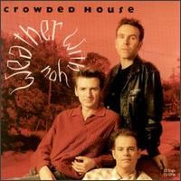
Two questions from the Crowded House song "Weather With You".. 1. Where is 57 Mount Pleasant Street? 2. What does "walking round the room singing stormy weather"mean? 57 Mount Pleasant...
Acland Street Precinct | St Kilda
⊜ Acland Street St Kilda
St Kilda is defined by two distinct retail strips, Fitzroy Street and Acland Street, with a magnificent Esplanade and the stunning St Kilda beach providing a natural link between the two precincts....
Bay Street, Port Melbourne
⊜ Bay Street Port Melbourne
Come experience Melbourne's best kept secret! Stretching all the way from the tranquil bay to the bustling city, Bay Street is indeed the very heart of Port Melbourne. This breezy, tree-lined...
Cameras Save Lives
⊜ Victoria
Road safety cameras save Victorian lives. They slow drivers down, making Victoria's roads safer. Mobile phone and seatbelt detection cameras are now enforcing Victorian road rules. Find a...
CityLink
⊜ Melbourne
CityLink is a 22km road connecting Melbourne's Monash, West Gate and Tullamarine freeways providing a link between Melbourne's CBD, port and airport. It includes the Burnley and Domain tunnels...
Collins Street | collinsstreet.com.au
⊜ Collins Street, Melbourne
Collins Street exudes style and glamour. It's a boulevard of chic designer shopping, five-star hotels, exclusive jewellers, grand heritage buildings and private clubs. It's also the city's premier...
EastLink | Peninsula Link
⊜ EastLink Operations Centre, 2 Hillcrest Avenue Ringwood
EastLink is the 39km freeway in Melbourne's east connecting the Eastern, Monash, Frankston and Peninsula Link freeways. It is the safest freeway in Melbourne, and bypasses 45 traffic lights...
Funny Melbourne Street Names
⊜ Melbourne
Melbourne street names with a funny twist. This fabulous list of names shows our town planners have a sense of humour. BATMAN AVENUE Who wouldn't want to live in a street named after a...
Linkt | Transurban
⊜ Melbourne
Melbourne's two toll roads: CityLink and EastLink With a Linkt account, you're good to go on all toll roads in Australia, including CityLink. Our range of accounts and passes provide you with...
Melbourne Street Name Origins
⊜ Melbourne
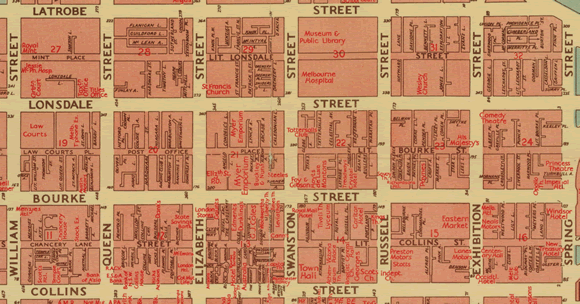
The debate over who actually named Melbourne's streets, and to whom those names indeed refer, is less important than their evolving role as socio-cultural signifiers. It was a Richard Bourke but...
Melways | Greater Melbourne Street Directory
⊜ 32 Ricketts Road Mount Waverley
Melway's is both a printed and online Greater Melbourne Street Directory. - Hierarchy of Roads - Detailed Public Transport routes. - Bicycle paths & shared road routes. - GPS compatible...
North East Link
⊜ Ringwood
Connecting the north and the south-east We're moving ahead on Victoria's largest road project. North East Link will finally connect the missing link in Melbourne's freeway network, while...
Transport Network Maps
⊜ Melbourne
View maps of Melbourne's transport network. Described by Public Transport Victoria (PTV) as a range of route and network maps to help you navigate public transport in Melbourne and...
UBD Street Directory
⊜ Melbourne Wide Melbourne
UBD is at the forefront of the mapping industry and is Australia's leading brand in street directories. Along with the yearly publication of the Melbourne street directory, UBD also publishes...
VicRoads
⊜ 180 Fyans Street Geelong South
VicRoads is responsible for maintaining and improving Victoria's 22km+ of arterial roads, 5k+ bridges and culverts. VicRoads also develops road safety programs, registers vehicles and licenses...
World's Shortest Highway | Chandler Highway
⊜ Chandler Highway Kew
At 1.4 km in length, the Chandler Highway in Kew (Melbourne, Victoria, Australia) is widely regarded as the world's shortest highway. Chandler Highway (road) began life as a railway track, part of...
⊜ Melbourne
Two questions from the Crowded House song "Weather With You".. 1. Where is 57 Mount Pleasant Street? 2. What does "walking round the room singing stormy weather"mean? 57 Mount Pleasant...
Acland Street Precinct | St Kilda
⊜ Acland Street St Kilda
St Kilda is defined by two distinct retail strips, Fitzroy Street and Acland Street, with a magnificent Esplanade and the stunning St Kilda beach providing a natural link between the two precincts....
Bay Street, Port Melbourne
⊜ Bay Street Port Melbourne
Come experience Melbourne's best kept secret! Stretching all the way from the tranquil bay to the bustling city, Bay Street is indeed the very heart of Port Melbourne. This breezy, tree-lined...
Cameras Save Lives
⊜ Victoria
Road safety cameras save Victorian lives. They slow drivers down, making Victoria's roads safer. Mobile phone and seatbelt detection cameras are now enforcing Victorian road rules. Find a...
CityLink
⊜ Melbourne
CityLink is a 22km road connecting Melbourne's Monash, West Gate and Tullamarine freeways providing a link between Melbourne's CBD, port and airport. It includes the Burnley and Domain tunnels...
Collins Street | collinsstreet.com.au
⊜ Collins Street, Melbourne
Collins Street exudes style and glamour. It's a boulevard of chic designer shopping, five-star hotels, exclusive jewellers, grand heritage buildings and private clubs. It's also the city's premier...
EastLink | Peninsula Link
⊜ EastLink Operations Centre, 2 Hillcrest Avenue Ringwood
EastLink is the 39km freeway in Melbourne's east connecting the Eastern, Monash, Frankston and Peninsula Link freeways. It is the safest freeway in Melbourne, and bypasses 45 traffic lights...
Funny Melbourne Street Names
⊜ Melbourne
Melbourne street names with a funny twist. This fabulous list of names shows our town planners have a sense of humour. BATMAN AVENUE Who wouldn't want to live in a street named after a...
Linkt | Transurban
⊜ Melbourne
Melbourne's two toll roads: CityLink and EastLink With a Linkt account, you're good to go on all toll roads in Australia, including CityLink. Our range of accounts and passes provide you with...
Melbourne Street Name Origins
⊜ Melbourne
The debate over who actually named Melbourne's streets, and to whom those names indeed refer, is less important than their evolving role as socio-cultural signifiers. It was a Richard Bourke but...
Melways | Greater Melbourne Street Directory
⊜ 32 Ricketts Road Mount Waverley
Melway's is both a printed and online Greater Melbourne Street Directory. - Hierarchy of Roads - Detailed Public Transport routes. - Bicycle paths & shared road routes. - GPS compatible...
North East Link
⊜ Ringwood
Connecting the north and the south-east We're moving ahead on Victoria's largest road project. North East Link will finally connect the missing link in Melbourne's freeway network, while...
Transport Network Maps
⊜ Melbourne
View maps of Melbourne's transport network. Described by Public Transport Victoria (PTV) as a range of route and network maps to help you navigate public transport in Melbourne and...
UBD Street Directory
⊜ Melbourne Wide Melbourne
UBD is at the forefront of the mapping industry and is Australia's leading brand in street directories. Along with the yearly publication of the Melbourne street directory, UBD also publishes...
VicRoads
⊜ 180 Fyans Street Geelong South
VicRoads is responsible for maintaining and improving Victoria's 22km+ of arterial roads, 5k+ bridges and culverts. VicRoads also develops road safety programs, registers vehicles and licenses...
World's Shortest Highway | Chandler Highway
⊜ Chandler Highway Kew
At 1.4 km in length, the Chandler Highway in Kew (Melbourne, Victoria, Australia) is widely regarded as the world's shortest highway. Chandler Highway (road) began life as a railway track, part of...
Don't miss a thing..
Get a weekly wrap of what's on in Melbourne in our free email newsletter | T&C..


