Docklands 3008 - History |

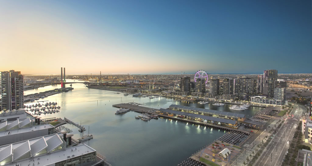
Docklands is a redevelopment site of 220 ha. of land and water (1997) at the western end of Melbourne's central business district.
It is administered by the Docklands Authority under an Act of Parliament, and the area may be enlarged or reduced by government order.
The area includes the railway yards west of Spencer Street, Victoria Dock and land westwards to the Moonee Ponds Creek, and part of South Wharf along the Yarra River.
Most of the land in Docklands was originally marsh, known as Batman's lagoon. An exception was Batman's Hill, a wooded knoll on the north bank of the Yarra River, west of Spencer Street.
In 1852 the Government granted 20 ha. of land for a railway terminus for proposed private railways to Williamstown and Echuca. They did not eventuate in the way intended, but the railway to Hobsons Bay, Port Melbourne, was opened from Batmans Hill station in 1854. The hill also served as a protective barrier for a powder magazine to its west. By 1863 rail traffic had increased, requiring the goods area to be extended, and two years later the hill was removed. Further extensions of the railways resulted in the goods areas being enlarged westwards as land was reclaimed.
In 1892 the Victoria Dock was opened, concentrating much of the Port of Melbourne's maritime freight next to the railway yards. West of the dock the Moonee Ponds Creek was used as a canal access for coal for railway locomotives. Coal was also unloaded for the West Melbourne Gas Works (west of today's Charles Grimes Bridge Road), which operated from 1855 to 1970. By the early 1900s the Victoria Dock/North Wharf area included transport companies, cool stores, freezing works, wool stores and shipping agents. Victoria Dock handled 90% of Victoria's imports in 1908.
During the 1930s depression areas near the railway canal were in disputed ownership among public authorities. The land was used as a tip, which gave an opportunity for unhoused people to build humpies and subsist from tip scratching. The area was named Dudley Flats and attracted comment by the slum reclamation movement. By the early 1940s the war-waste recovery activity eliminated tip scratching and the Dudley Flats inhabitants went elsewhere.
In 1941 Victoria Dock and North Wharf handled 52% of the port's cargo tonnage. Containerization caused cargo handling to be moved downstream in the 1960s, and road haulage was taking much of the railway intrastate freight haulage. In 1985 Victoria Dock and North Wharf's share of cargo was 4%, and several country railway lines were undergoing closure. The Docklands Authority was formed in 1991 for redevelopment of the area.
In 1997 the Authority invited development bids for five of seven precincts in Docklands: Business Park (36 ha.); Technology Park (7 ha.); Batmans Hill (15 ha. - museum, retail, residential); Yarra Waters (15 ha. - residential, commercial marina); and Victor Harbour (30 ha. - tourism, residential). The other precincts are for a stadium and the railway land next to Spencer Street.
In the railway yards a goods shed, relocated from the 1880 Melbourne Exhibition, and a brick goods shed and offices and clock tower (1889) are on the Victorian Heritage Register. The Missions to Seamen building, Flinders Street Extension, is also on the Register.
❊ Web Links ❊
➼ Docklands 3008 - History
❊ Also See... ❊
➼ Docklands 3008 + The District Docklands | Guide
Disclaimer: Check with the venue (web links) before making plans, travelling or buying tickets.
Accessibility: Contact the venue for accessibility information.
Update Page


