Elsternwick 3185 |

Nestled between Elwood and Caulfield, just 9kms south of Melbourne CBD, Elsternwick is the perfect place for a daytime or evening adventure, combining old-world charm with modern indulgence.
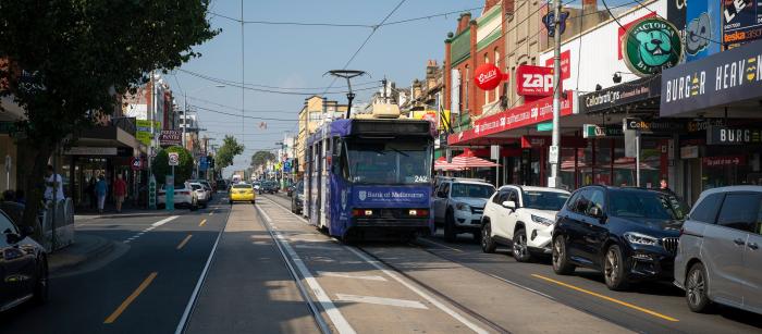
Located on Glen Huntly Road, and connected by the Sandringham train line and 67 tram, Elsternwick is just a short ride away and offers a diverse range of bakeries, restaurants, fashion boutiques, and plenty more. With more than 200 businesses, there's something for everyone.
Elsternwick is a residential suburb 9 km. south-south-east of Melbourne between bayside Elwood and Caulfield South. The name is derived from "elster", the German word for magpie and the Anglo-Saxon "wick"meaning village. Charles Ebden (the builder of Black Rock House, Black Rock, 1856), also had a house in the Elsternwick area, which it is though he named Elster. The name Elsternwick came into general use in the late 1850s.
Elsternwick village was surveyed in 1856, situated on the Elster Creek, which later became the Elwood Canal. The village's location is partly occupied by today's Gardenvale. Elsternwick's western boundary is notionally in Elwood where Elsternwick Park is situated. Elsternwick primary school (1889) is nearby. The suburb extends eastwards across the Nepean Highway and the railway line, particularly along the Glenhuntly Road shopping strip for about one-and-a-half kilometres to Kooyong Road.
In 1861 the Melbourne and Suburban Railway Co. completed the railway line from Melbourne to Brighton, via Elsternwick. The effect on Elsternwick was to make its large residential estates more accessible to Melbourne rather than to provoke subdivisions. By 1880, however, some large land owners released land for subdivision and the process gathered pace during the coming decade. The tramline was opened along Glenhuntly Road (where the railway line and station intersected with it), in 1889. The short-lived Rosstown railway line from Oakleigh (1879) was opened at the conclusion of a long debate which held out the prospect that the railway line from Melbourne to Gippsland might run via Elsternwick. (In fact, it ran via Caulfield.)
The post office (1891) is on the Victorian Heritage Register.
Elsternwick was situated astride three municipalities - Caulfield, Brighton and St. Kilda. At the end of the 1880s attempts were unsuccessfully made for it to become a separate borough. It had a census population of 6,790 in 1911.
Elsternwick Park was mostly a swamp through which the Elster Creek (Elwood Drain), ran, and was used for horses, grazing and later recreation. The Elsternwick Golf Club moved from the reserve in 1925 to Kingston, but a public course was kept in the northern part and ovals formed in the remainder.
The strip shopping centre along Glenhuntly Road became a strong retail location, and by the 1990s was ranked in the best ten in metropolitan Melbourne. Private schools were established: O'Neill College (Presentation Sisters, 1907), Cato College (Methodist Ladies/Wesley, 1930) and the Leiber Yaweh and Sholem Aleichem Colleges for the substantial Jewish population in the area. Immediately over Elsternwick's boundary on Glen Eira Road is Caulfield Grammar School (1881).
In the north of Elsternwick is the suburb of Ripponlea and in the south is Gardenvale.
elsternwick.com
❊ Address ❊
⊜ Glen Huntly Road Elsternwick 3185 View Map
❊ Web Links ❊
➼ Elsternwick 3185
Disclaimer: Check with the venue (web links) before making plans, travelling or buying tickets.
Accessibility: Contact the venue for accessibility information.
Update Page


